HOME
»
Gorre and Daphetid Railroad - The Slides
»
Set_00
»
Viewing
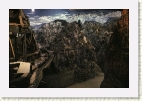
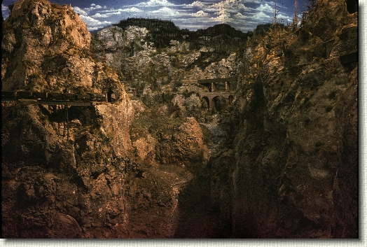
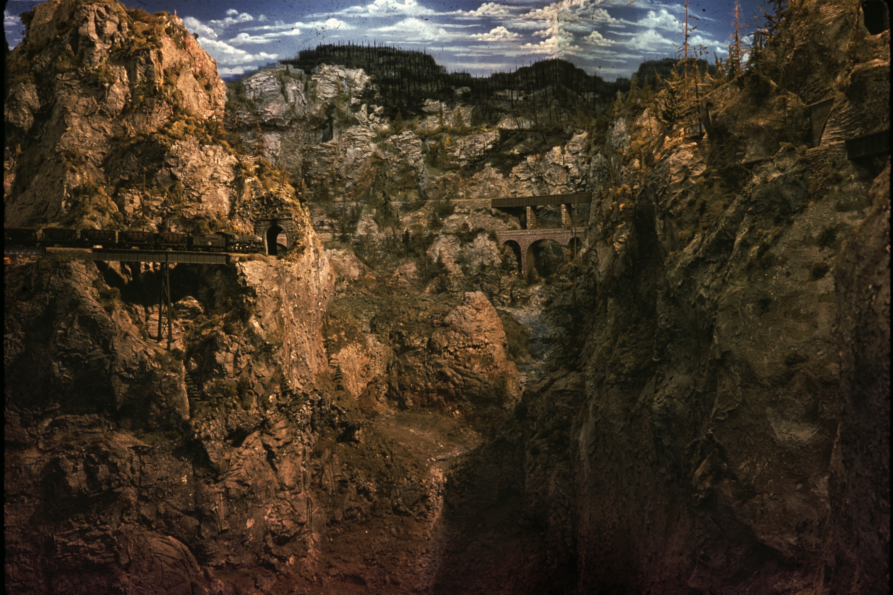
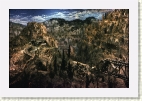
s0_027_mountains_may61
[Image 27 of 108]
::
Jump To
- Set_00
- Page 1
- Page 2
- Page 3
- Page 4
- Page 5
- Page 6
- Page 7
- Page 8
+ Set_01
+ Set_02
Comment:
Looking up Devils Gulch. Sims Loop small bridge and tunnel on left.
s0_027_mountains_may61.jpg - 3072 x 2048 - (2.14MB)
8/8/06 2:50 AM
Album last updated on 8/16/06 7:35 PM
"John Allen's Gorre and Daphetid Railroad" Copyright 2006 Peter T. Prunka all rights reserved